


London Tube Map Traditional Layout from digitalurban on Vimeo.
Taking this one step further, they've morphed this with plasticine look of the lines into a Google Map.
"The routes on the interactive image below illustrates a work in progress produced so we can easily identify the errors". Here's a screengrab, so visit Digital Urban's site to see it in action
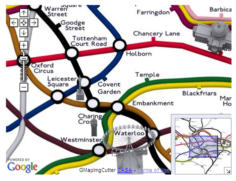
There are a few errors here and there but it should only need a few tweaks to be near a complete version which can then be morphed and changed as needs be."
You can also also see the 'Google Maps' version in full screen. There's more about their mapping here.
Many thanks to Ianvisits for the heads up to this.
I love a lot of these creative visualisations of the map and seeing the geographical map from this perspective is leaps on from Simon Clarke's original Geographical Map that it was based on.
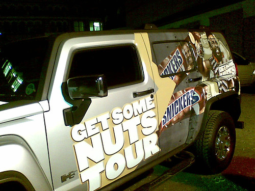
One person who's used to hanging out of helicopters and is very used to seeing in air city scenes is Mr T. Last night I was lucky enough to meet him as part of his Snickers Get Some Nuts tour.
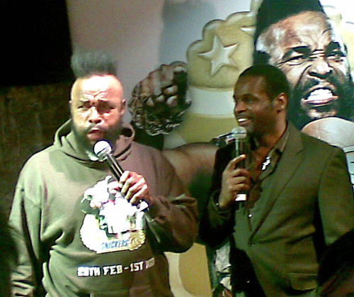
Typically my camera ran out of battery juice during the night, but there's a mixture of pictures from my Canon and my cameraphone in the following Mr T in London set. You'll also spot Craig out of the very first Big Brother in some of them!


No comments:
Post a Comment